NC declares emergency; NYC, NJ, and New England beaches close as Erin’s wind field expands.
The storm at a glance: Hurricane Erin has strengthened into a Category 2 with 110 mph winds and a rapidly expanding wind field. North Carolina is under a statewide emergency, mandatory evacuations are in place on the Outer Banks, and beaches from New York City to Nantucket are closed due to life-threatening rip currents and high surf.
Erin’s Current Status and Track
At 11 a.m. ET, the National Hurricane Center (Advisory No. 37) placed Erin about 365 miles south-southeast of Cape Hatteras, moving north at 13 mph. A turn toward the north-northeast is expected later today, accelerating to the northeast by Thursday. The storm’s central pressure is 965 mb, and additional strengthening to a major hurricane is possible before weakening begins Friday over cooler waters.
Hurricane-force winds extend 90 miles from the eye, and tropical-storm-force winds reach out 265 miles—meaning gusty conditions and dangerous surf will affect coastlines well offshore. A Tropical Storm Warning is in effect from Beaufort Inlet, NC, to Chincoteague, VA, and a Storm Surge Warning (2–4 ft) covers Cape Lookout to Duck, NC.
Key Messages from the NHC
Erin’s advisory warns: “Life-threatening surf and rip currents will impact beaches of much of the U.S. East Coast during the next several days,” with significant beach erosion and overwash likely along the Outer Banks. Tropical-storm-force gusts could reach the Mid-Atlantic and southern New England Thursday into early Friday.
North Carolina: State of Emergency and Outer Banks Impacts
Executive Order and Evacuations
Governor Josh Stein issued a statewide State of Emergency on August 19 (Executive Order 20), waiving certain regulations to streamline response. “Hurricane Erin will bring threats of coastal flooding, beach erosion, and dangerous surf conditions,” Stein said. “North Carolinians along the coast should get prepared now, ensure their emergency kit is ready, and listen to local emergency guidelines and alerts in the event they need to evacuate.”
Mandatory evacuations cover Hatteras Island (Dare County) and Ocracoke Island (Hyde County). Visitor evacuations began August 18; residents departed on August 19. Transportation assistance was provided for those without vehicles, and a state shelter in Warren County stands ready for evacuees and their pets.
Highway 12 and Ferry Suspensions
NC 12, the lone roadway across the Outer Banks, is subject to repeated ocean overwash. NCDOT warns that “there will be times over the next week that NC 12 becomes impassable due to significant overwash,” especially near high tides. All ferry service between Hatteras and Ocracoke remains suspended until sea conditions improve.
Coastal Flooding, Surf, and Power Outages
Outer Banks residents are facing 10–20 ft waves offshore, 2–4 ft of storm surge, and widespread dune erosion. Floodwaters have inundated low-lying roads, and more than 25,000 customers in coastal counties are without power as of midday today. Crews from Dominion Energy and Duke Energy are staging for rapid restoration once winds ease.
Northeast Beaches: Closures, Red Flags, and Rip Currents
New York City
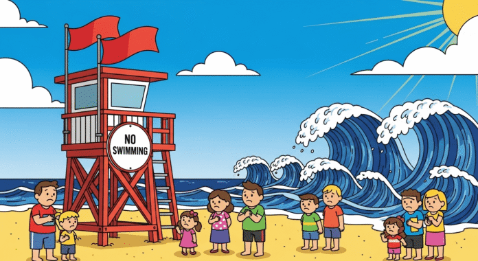
All NYC ocean beaches are closed for swimming Wednesday and Thursday. Waves up to 13 ft and strong rip currents represent a severe hazard. “Even if you are an experienced swimmer, it is important—the beaches are closed,” Mayor Eric Adams said. Lifeguards patrol the shore, and “No Swimming” signs line every access point.
New Jersey Shore
From Seaside Heights to Wildwood, red flags fly along the boardwalk and patrol teams bar water entry. Governor Phil Murphy urged residents to heed lifeguards’ warnings and avoid the surf entirely this week as Erin’s swells peak.
Massachusetts and Rhode Island
Nantucket has closed all south shore beaches to swimming, and Cape Cod National Seashore advises against standing near breaking waves on rocky ledges. The National Weather Service Boston/Norton issued high surf and rip current advisories for coastal Plymouth, Barnstable, Dukes, and Nantucket counties through Saturday morning, with waves up to 13 ft.
In Rhode Island, Governor Dan McKee and the DEM warn of “life-threatening rip currents” at south-facing beaches. “We urge all Rhode Islanders to exercise caution along the shoreline and avoid unnecessary risks,” McKee said, emphasizing that first responders could be endangered by water-rescue calls.
Forecast Hazards and Timing
- Surf and Rip Currents: Begin impacting beaches from Florida to New England today, persisting through Friday. Beach erosion and sudden over-wash are likely.
- Tropical-Storm-Force Winds: Expected late today along the NC Outer Banks and Virginia coast; gusty conditions reaching the Mid-Atlantic and southern New England Thursday into early Friday.
- Storm Surge and Coastal Flooding: 2–4 ft surge from Cape Lookout to Duck, NC, combined with large breaking waves, will create intermittent overwash and localized flooding near high tide.
- Rainfall and Inland Flooding: Outer bands may drop 1–2 inches of rain in the Outer Banks; localized urban or flash flooding possible in poorly drained areas.
Safety Checklist
To stay safe through Hurricane Erin:
• Avoid entering the ocean when red flags are posted or beaches are closed.
• Never drive through floodwaters—“Turn Around, Don’t Drown.”
• If caught in a rip current, remain calm; float or tread water, then swim parallel to shore until free of the current.
• Keep an emergency kit ready with water, nonperishable food, flashlights, chargers, and important documents.
• Monitor local updates from NHC, NWS, state emergency management, and municipal authorities.
Conclusion and Call to Action
Hurricane Erin’s widening wind field means hazards well beyond its track, from North Carolina’s barrier islands to New England shores. Respect mandatory evacuations, obey beach closures, and share this update with family and friends along the coast. Check back for the latest advisories and safety guidance as Erin progresses northward. Stay informed, stay prepared, and stay safe.
Invite you to bookmark this page and share your own storm-safety tips in the comments below.


